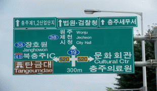
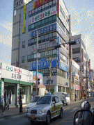
Cheongju-si
 |
Cheongju has been an important provincial town since ancient times. In the Cheongju Mountains, specifically in the one where Sangdang Sanseong is located, ruins dating from the Old Stone Age to the Bronze Age have been found. Settlements associated with the Paleolithic Age have also been discovered at Cheongju such as the Durubong Cave Site.
After the unification of the kingdoms by Silla in 676, which caused various parts of Korea to adapt Buddhism including Cheongju, because the Silla culture was connected with the Silk Road, which brought the Buddhist religion from Nepal across Northern China to the Korean Peninsula. In the Goryeo era during the reign of Gwangjong, several monuments related to Buddhism were created, among them are Cheol Danggan, built during the year 962 in the center of the city near the remains of Yongdu Temple, which is a flagpole to hang the Dang flag, which is raised to pay tribute to Buddha. Cheol Danggan was listed as a National Treasure in 1962 by the South Korean government. In the Chosen period, the Cheongju region began to adopt Confucianism as its main religion.
Throughout the history of Cheongju, different temples were established during different periods in the history of the Korean peninsula such as the Buddhist Yonghwasa Temple dating back to the Goryeo period in addition to the Bulguksa Temple established in the 8th century during the Silla Dynasty period. Cheongju temples were the first places where advances in Korean printing such as book printing were established, and one of these important documents was printed at Heungdeok Temple during the Goryeo Dynasty, specifically during the year 1377.
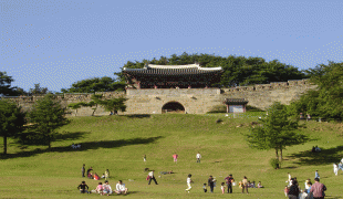
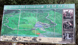
One of the first schools established in North Chungcheong Province was founded in Cheongju City during 1896. During the Baekje Dynasty period, several tombs were built around the city, in addition to Joseon Dynasty period forts such as Sangdangsanseong, which served to connect the northern and southern provinces after the Japanese invasion of 1592.
In 1593, the Battle of Cheongju took place between Japanese forces and the Joseon kingdom that then ruled the Korean peninsula during the Hideyoshi's Invasions of Korea, in which more than 8,000 Korean warrior monks participated.
The government of the province relocated here from Chungju in 1908. The opening of the Chungbuk-line in 1926 sparked regional development. In 1946, Cheongju and Cheongwon-gun were separated, and in 1949, Cheongju was upgraded to Cheongju City. Afterwards, it went through the separation of administrative dong and their transfer to Cheongwon-gun, with 2 branch offices (East and West) established in July 1989 that were upgraded to Sangdang-gu and Heungdeok-gu in January.
Cheongju experienced one of the largest population growths in Korea, having almost quadrupled its population from 147,000 in 1970 to 582,158 in 2000.
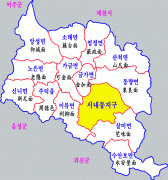
Map - Cheongju-si
Map


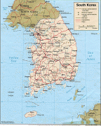


Country - South_Korea
 |
 |
| Flag of South Korea | |
The Korean Peninsula was inhabited as early as the Lower Paleolithic period. Its first kingdom was noted in Chinese records in the early 7th century BCE. Following the unification of the Three Kingdoms of Korea into Silla and Balhae in the late 7th century, Korea was ruled by the Goryeo dynasty (918–1392) and the Joseon dynasty (1392–1897). The succeeding Korean Empire (1897–1910) was annexed in 1910 into the Empire of Japan. Japanese rule ended following Japan's surrender in World War II, after which Korea was divided into two zones; a northern zone occupied by the Soviet Union and a southern zone occupied by the United States. After negotiations on reunification failed, the southern zone became the Republic of Korea in August 1948 while the northern zone became the communist Democratic People's Republic of Korea the following month.
Currency / Language
| ISO | Currency | Symbol | Significant figures |
|---|---|---|---|
| KRW | South Korean won | â‚© | 0 |
| ISO | Language |
|---|---|
| EN | English language |
| KO | Korean language |